All Avalanche Incidents for Advisory Year 2023-24
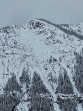
WS-N-R5-D4-O
Elevation: 10,200
Aspect: N
Coordinates: 44.9682, -109.9640
Caught: 0 ; Buried: 0
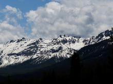
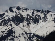
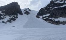
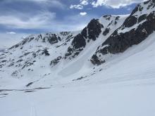
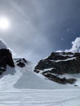
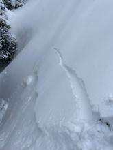
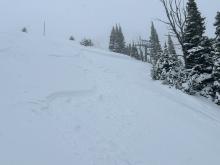
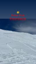
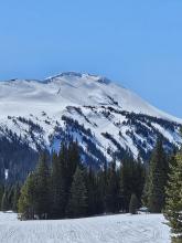
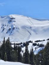
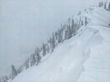
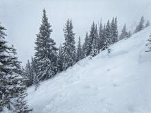
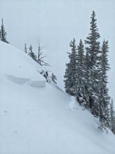
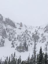
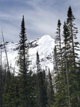
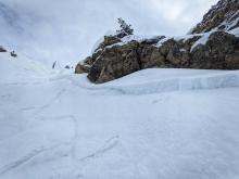
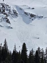
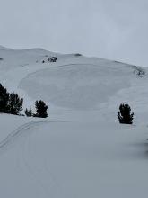
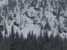
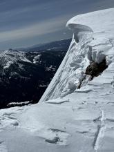
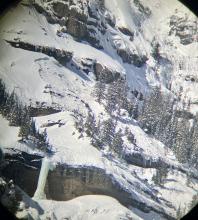
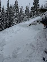
Photos taken 6/10/24 around 1pm. Wet slab in Republic Creek south of Cooke. I estimate 10-20’ deep and 1000’+ wide. The past 5-6 days have been warm, and previous night there was steady rain all night into the mid morning, so not out of the question that it happened within 24 hrs, likely within the last 1-3 days.
More Avalanche Details
ASu-R3-D2.5
Elevation: 10,800
Aspect: NE
Coordinates: 44.9701, -109.4620
Caught: 0 ; Buried: 0
From IG messages on June 1 2024: "there were two riders and a dog on the slope. One rider was partially caught and rode out when everything stopped moving. The dog was very afraid and got stuck at the crown and rocks on the lookers left. Happened about 3pm today within the first 20 riders. Started with a small slide and propagated much larger when it got closer to the rocks."
From antoher ob. "At approximately 15:40 a D3 avalanche on the Gardiner headwall broke. It was triggered by a snowboarder and his dog. The run had already been tracked by skis and snow machines but the trigger point was slightly farther skier right and appeared to trigger a convex wind slab. Several skiers, boarders, and riders were in the area but there were no burials or injuries"
More Avalanche Details
Coordinates: 45.3407, -111.3910
Caught: 0 ; Buried: 0
shooting cracks in the top 4 to 5 inches of new snow in middle basin
More Avalanche Details
SS-AS-R2-D1-I
Elevation: 7,500
Aspect: NE
Coordinates: 45.8039, -110.9200
Caught: 0 ; Buried: 0
From obs 5/23/24: "Toured to the top of PK during today’s storm. Snow was very wet and heavy. We saw no other slides or signs of instability on the way up. Coming down skiers right of flippers, all 3 of us caused small slides and cracking within the new snow. I triggered the largest slide, which was 6-8” deep and 12’ wide."
More Avalanche Details
SS-AMu-R2-D2
Elevation: 10,000
Aspect: E
Coordinates: 45.0661, -109.9590
Caught: 0 ; Buried: 0
From email 5/11/24: “Hey Guys, here are a few photos from the weekend.... the fisher peak avalanche happened today. Maybe cornice drop?”
From email 5/16/24: "I saw the photo of the fisher peak avalanche on the website. Figured I could fill in the blanks. Not a natural slide, snowmobile triggered.
At approximately 12:15pm last Saturday I was climbing above fisher bench and unintentionally set off a slab avalanche on fisher peak. I was jumping the cornice at the ridge and had a massive slope collapse, followed by shooting cracks and propagation downslope. I was able to wheelie through the crown and sidehill above the slide away from the debris area.
5 minutes before my climb, another snowmobiler put a high mark 60 ft away from where I climbed with no results. There were numerous tracks on the slope prior to this avalanche, I found the weak spot. My riding partner was watching me from a safe zone further south, as we knew there was new snow instabilities to watch out for, at a minimum.
We rode all day Friday without any obvious instabilities on similar slopes. We didn’t see the sheep mountain slide Friday morning. I took some pictures of the slide right after it happened. See attached…"
More Avalanche Details
SS-AMu-R3-D2
Elevation: 9,500
Aspect: NE
Coordinates: 45.0722, -109.9280
Caught: 0 ; Buried: 0
From email 5/11/24: “Hey Guys, here are a few photos from the weekend. The sheep Mountain Avalanche was Snowmobile triggered on Friday and the fisher peak avalanche happened today. Maybe cornice drop?”
More Avalanche Details
SS-AMr-R2-D1
Elevation: 9,000
Coordinates: 45.0745, -109.9070
Caught: 0 ; Buried: 0
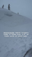
From IG story 5/8/24: "@mtavalanche remote triggers today in Cooke City. 2-4' of fresh north of round lake."
More Avalanche Details
SS-N-R3-D2-I
Elevation: 8,400
Aspect: E
Coordinates: 45.8156, -110.9230
Caught: 0 ; Buried: 0
From email 5/8/24: "A few snaps from today. Observed several D2 slides between sluice box and the nose. I didn't see the toe of these slides, but it looked like there were running with some speed into mid elevation terrain. Slabs were most common in winded terrain, but slides flanked out on new/old interface and 4/26 crust (these layers are not very far apart) even in sheltered middle elevation terrain. Visibility was poor, but I'd expect to see similar large slides in steep, winded terrain
4/26 crust down:
55-60cm at 6500
65-70cm at bridger mid
75+cm at ridgeline"
More Avalanche Details
SS-R2-D2-S
Elevation: 8,500
Aspect: NE
Coordinates: 45.8156, -110.9230
Caught: 0 ; Buried: 0
A skier near the top of the Alpine Lift at Bridger Bowl ski area took a photo of three avalanche crowns near Peter’s Point.
More Avalanche Details
SS-ASc-R1-D1-S
Aspect: W
Coordinates: 45.3407, -111.3910
Caught: 0 ; Buried: 0
A skier triggered an avalanche on a test slope in Beehive Basin, breaking 12-16" deep and 75' across. The slide failed within the new snow.
More Avalanche Details
N
Coordinates: 45.8301, -110.9340
Caught: 0 ; Buried: 0
On 5/4/24 “…. a friend toured around Wolverine today. On his way out he heard a slide breaking trees (just before noon). Unknown location but he said it sounded like it was around/ above Texas Meadows. The action continues!”
More Avalanche Details
L-ASu-R2-D2-I
Elevation: 10,000
Aspect: E
Coordinates: 45.0003, -109.9540
Caught: 0 ; Buried: 0
From obs.: “Our party (3) triggered a significant wet loose slide on the fin today. I, the first skier dropped in next to existing tracks from earlier in the morning. I made a couple of small turns in unskied snow to test it and decided that not much was moving. As I continued down the wet surface snow started to slide and accumulate. My partner called me on the radio to tell me a lot of snow was moving behind me and I cut left. I traversed hard to lower angle terrain until I felt I could safely descend the rest of the slope. My partners descended the bed surface until they could traverse out.
We made several key mistakes today. We knew it would be warm and that we should be up and down early. We left later than planned, moved slower than expected and failed to adjust our plan. We mistook lack of wet loose activity on similar aspects and elevations on features we could see as sign of stability. We failed to make a plan B or establish a turnaround time. We interpreted a party ahead of us that skied the slope as a go ahead. Another party approaching behind us added pressure to go. They also skied the slope after us in similar style to my partners.
In our favor, we communicated well, radios were key, stayed calm and we managed ourselves through the situation. I feel humbled and lucky to have gotten away with a free lesson. One that I didn't think I should have needed.”
More Avalanche Details
SS-AS-R2-D1.5-I
Elevation: 8,300
Aspect: N
Coordinates: 45.8156, -110.9230
Caught: 0 ; Buried: 0
From email 5/2/24: "Triggered in the virtues this evening. 40' wide, 4-12" deep, failed as a dense, wind-packed slab on the rain/sun/heat crust underneath the most recent snow. I had marginal visibility but it looked like there were similar small-ish wind pockets that had failed in a few spots. Good skiing up high, fun first day up there."
More Avalanche Details
SS-N-R1-D1.5
Elevation: 9,500
Aspect: N
Coordinates: 45.0530, -110.0100
Caught: 0 ; Buried: 0
From obs. 5/2/24: "Wind load on old crust, probably from Wednesday."
More Avalanche Details
SS-ASu-R2-D1.5-I
Elevation: 9,500
Aspect: NE
Coordinates: 45.0722, -109.9280
Caught: 0 ; Buried: 0
From email 5/1/24: "Hi crew. I triggered a soft slab avalanche on the North side of Sheep Mountain today. D1.5 200’ wide ran 200’. Crown was 6-12’’ deep. I was able to ride out of it and anchor in a safe spot.
It broke on our 7th lap and we had seen no signs of instability prior to the avalanche but wind loading was occurring and obvious. The avalanche broke and on a dirty crust that formed during a rain event last week."
More Avalanche Details
Caught: 0 ; Buried: 0
"We toured to Elephanthead Mountain today (4/27/24). Most of the couloirs emptying into Mission Creek (e.g. Das Ist Ice, Pitchfork Couloirs) showed signs of recent, large scale wet slides. Higher on the mountain, we observed fairly recent avalanche debris and crowns of 4-5 feet. On our descent of Mission Creek, we crossed large, wet slide debris fields that buried our earlier skin track (see pic). Our decision was to stick to low angle terrain and to steer clear of runout zones of any couloirs."
More Avalanche Details
WS-N-R2-D2.5-O
Elevation: 8,500
Aspect: N
Coordinates: 45.0202, -109.9380
Caught: 0 ; Buried: 0
Wet snow activity on Wall Mountain near Silver Gate, Republic Mtn. and Henderson Bench near Cooke.
More Avalanche Details
Coordinates: 45.3407, -111.3910
Caught: 0 ; Buried: 0
From obs: "When setting out to Beehive Basin today we only imagined wanting to bail if rain line was at the trailhead, but had not expected our seasons long standing PWL to turn us around. With a few inches of snow at the trailhead and temps just at freezing we set out. The new snow yesterday/last night capped a warm snowpack, keeping the snowpack from freezing at all (no crusts or other signs of superficial freezes up to 9,2000ft where we bailed despite the mid-20’s temps recorded overnight). Almost immediately out of the trailhead we got thunderous collapses so big we at first thought it was noise from control work at Big Sky. Further along we got collapses extending hundreds of feet out, valley wide and echoing up the basin. We dug to the bottom out of curiosity and found a saturated and unfrozen snowpack. The bottom 30cm was still all facets, giving the appearance that the remaining 90-110cm of consolidated snowpack was floating on air. We’re assuming the whumps/collapses are traveling along this layer of basal facets. I’m sure once it gets a solid freeze things will be alright again, but will the new snow continue to insulate the snowpack the next few nights despite the forecasted solid freezing temps? Or is this only a phenomenon that happens the 1st night of new snow falling on a warm snowpack? "
More Avalanche Details
SS-AS-R1-D1
Elevation: 9,750
Aspect: N
Coordinates: 45.5364, -112.0030
Caught: 0 ; Buried: 0
Toured up around bell lake today and after a night of wind, triggered a very small wind slab in a north facing couloir at around 9500-10000ft. It was almost 10” deep and was about 10-15ft across. Snow was being loaded through out the day and was staying cold up high.
More Avalanche Details
L-AS
Coordinates: 45.3477, -111.3890
Caught: 0 ; Buried: 0
From obs: "We saw several loose avalanches on WSW, ESE & SSE aspects of the ridge between beehive and bear basin. The one on the ESE slope may have been skier triggered (by another group) and the rest appeared to be natural. We found a strong crust beneath the foot of new snow throughout our route. We didn't see any cracks or whumphs, and the new snow wasn't reactive in hand pits. The snow surface was getting wet as we exited to the beehive trailhead around 3pm."
More Avalanche Details
L-AS-R1-D1
Aspect: NE
Coordinates: 45.0003, -109.9540
Caught: 0 ; Buried: 0
A skier triggered multiple loose snow avalanches while skiing near the Fin off of Republic Mountain in Cooke City.
More Avalanche Details
SS-ASu-R1-D1
Elevation: 9,500
Aspect: N
Coordinates: 45.5289, -112.0180
Caught: 0 ; Buried: 0
From obs: "However, where wind or sun had strengthened the slab this surface layer was reactive, with sluffs entraining significant amounts of snow and one small slab that I managed to trigger. I popped this slab underneath a mild, somewhat cross-loaded convexity on a north face near treeline, and it broke around 30 feet wide, 4-6 inches deep, and ran ~ 300 feet (N, 9500', SS- ASu - R1/D1)."
More Avalanche Details
L-AS
Coordinates: 45.8570, -110.9510
Caught: 0 ; Buried: 0
From obs: "Skied the Banana Coulior off Ross today (04/18). 6-8" of fresh, dry snow has fallen and lies above a bomber crust that was observed on all aspects we traveled on. The weak interface between new, dry snow and the pervasive crust allowed for a large sluff, or dry-loose slide, that began near the top of the Banana Coulior and ran for ~ 500'"
More Avalanche Details
WS-AMr-R3-D2-O
Elevation: 8,100
Aspect: NE
Coordinates: 45.4802, -111.1320
Caught: 0 ; Buried: 0
From IG message 4/17/24: "Remote trigger up little bear today. Went to the groundish."... "It was definitely wet below the new snow. It was north east facing at 8100 ft"
More Avalanche Details
WS-N-R3-D2-O
Elevation: 7,600
Aspect: SE
Coordinates: 45.8391, -110.9370
Caught: 0 ; Buried: 0
from obs. 4/25/24: "Came across a relatively large wet avalanche when approaching Texas meadows from Bradley’s meadows. Elevation around 7600ft, aspect, SSE. Depth: to ground.
Considering the new snow on top of the debris, I’m guessing this slid prior to the storm last week. The slide path was melted out to dirt. Out of curiosity, we dug just to the lookers right of the slide and found soft snow near the ground - still evidence of crystal structure but could make a snowball if squeezed. Best guess is that a point release wet slide entrained enough snow to step down and release the whole face."
More Avalanche Details
WS-N-R3-D2-O
Aspect: SE
Coordinates: 45.0773, -110.0210
Caught: 0 ; Buried: 0
From obs on 04/17/2024: "Wet slab 150-200 ft across, SE shoulder of Abundance towards Wolverine. Looks to have maybe happened before new snow. New snow 6-8 was extra funky, 2-3 powder on a rain? crust on heavy wet. Bonded to unsupportive melt freeze on completely saturated glop. Lots of short running sluffs"
More Avalanche Details
WS-AMr-R2-D2-O
Elevation: 8,600
Aspect: E
Coordinates: 45.0607, -111.2720
Caught: 0 ; Buried: 0
From IG: A group of riders noted very wet snow west of Cabin Creek and Southwest of the Taylor Fork. They were sinking to the ground where it was unconsolidated. The group remotely triggered a wet slab avalanche from the ridge top. There were shooting cracks that connected their location to the avalanche. This is an interesting of persistent weak layer and wet snow avalanche problems.
More Avalanche Details
WS-N-R2-D2-O
Elevation: 7,500
Aspect: N
Coordinates: 44.6432, -110.9540
Caught: 0 ; Buried: 0
Saw what looked like a wet slab avalanche from the road along the Madison River. Roughly north facing slope at 7500'.
More Avalanche Details
WS-N-R2-D2-G
Coordinates: 44.8524, -111.3920
Caught: 0 ; Buried: 0
From IG: Wet slide to the ground above Quake Lake.
More Avalanche Details
WL-N-R2-D2.5-O
Elevation: 8,400
Aspect: NE
Coordinates: 45.8244, -110.9280
Caught: 0 ; Buried: 0
On sunday 4/14 a large wet loose avalanche ran naturally in closed terrain at Bridger. The larger of the two in the photo, on the right, is from 4/14 at 1230pm. The other slide, on the left, happened yesterday or late in the day Friday.
More Avalanche Details
WL-N-R2-D2-O
Elevation: 8,500
Aspect: E
Coordinates: 45.8512, -110.9480
Caught: 0 ; Buried: 0
This afternoon I drove up Bridger canyon to Seitz Rd to see the extent of wet snow activity, and stopped in a few places to look with binoculars. There were many loose wet avalanches that ran over the last 1-3 days. I estimate they involved the upper 6-12" of snow. Activity was widespread and many slides were plenty large enough to be dangerous, but there was nothing especially remarkable about the size and I saw zero wet slabs.
Temperature was 65-70 degrees in the canyon, mostly clear skies with a few clouds, calm to light wind.
More Avalanche Details
C-N
Aspect: NE
Coordinates: 45.1317, -109.8870
Caught: 0 ; Buried: 0
From obs: "Natural cornice failure and small slab on Iceberg Peak’s NE face. We skied by the day prior and judging by what the wind did to our tracks overnight, this looked like it happened in the morning."
More Avalanche Details
C-ASu
Coordinates: 45.1582, -111.4770
Caught: 0 ; Buried: 0
From obs: " Unintentionally triggered a large cornice collapse on the south face of the Sphinx. "
More Avalanche Details
WL-N-R2-D2
Coordinates: 46.0187, -110.2760
Caught: 0 ; Buried: 0
Riders saw several natural wet snow avalanches while riding on the west side of the Crazy Mountains. The largest of these was 500' wide, D2. All these avalanches happened in the upper 40cm of the snowpack.
More Avalanche Details
N-R2-D2
Elevation: 9,000
Aspect: E
Coordinates: 45.7869, -110.9350
Caught: 0 ; Buried: 0
Driving home from Bridger Bowl I spotted a number of wet loose avalanches in Argentina bowl. It was 1:30 PM when I saw them and the sun was still blazing. I would expect there was more activity as the afternoon progressed.
More Avalanche Details
SS-AS-R2-D1.5-S
Elevation: 8,200
Aspect: SE
Coordinates: 45.8586, -110.9560
Caught: 0 ; Buried: 0
From IG message: “Rode the banana today.. lots of fast moving sluff. Had a mid elevation pocket pop. New snow seemed to have bonded well, the spot that did pop had formed into 12” slab below rock face. Little to no signs of instability.”
More Avalanche Details
SS-ASu-R2-D2
Elevation: 8,200
Aspect: N
Coordinates: 45.9483, -110.9900
Caught: 0 ; Buried: 0
From obs : "After skiing two laps on East facing terrain two basins north of Anger Lake basin and seeing no significant signs of instability, we descended into a north facing gully around 8,200ft and triggered an avalanche on the new snow/old crust interface. The crown was 4-18 inches deep and propagated the entire width of the gully ~40 feet and ran the entire length of the gully ~500 vertical feet. I was able to ski out of the avalanche right as it broke and was not carried. "
More Avalanche Details
SS-AS-R2-D2-S
Elevation: 8,300
Coordinates: 45.8288, -110.9310
Caught: 0 ; Buried: 0
While skiing near the ramp we saw several skier-triggered storm slabs and loose snow avalanches. Most were R2/D1.5. The largest of these happened south of the Wolverine Cirque below a cliff band, R2/D2.
More Avalanche Details
SS-AM-R1-D1.5
Coordinates: 45.9043, -110.9580
Caught: 0 ; Buried: 0
Riders on 04/07/2024 saw a human-triggered avalanche on the shoulder of Hollywood Bowl that was triggered by another party.
More Avalanche Details
SS-ASu-R2-D2
Coordinates: 45.9233, -110.9800
Caught: 1 ; Buried: 0
From obs: "Skier triggered slide in one of the Love chutes dropping into Frazier basin. Skier attempted to ski cut the top of the chute, snow was not reactive. He began to ski the chute and triggered a wind slab about 18” deep which failed the crust from the recent warm stretch. Was carried about 200 feet and managed to self arrest on the side of the chute while the slide continued to the bottom. No serious injuries. "
More Avalanche Details
SS-AS-R1-D1-S
Aspect: NE
Coordinates: 45.8822, -110.9520
Caught: 0 ; Buried: 0
A skier triggered a small avalanche on a steep north-facing pitch, but it did not run far. We saw limited cracking on a layer within the new snow generally 4" to 1 foot deep, and got an ECTP11 on this layer in one of our pits on the east-facing pitch near the standard ski track. Our other pits, one lower on the east face and to the north of the saddle at the top of the Throne, resulted in ECTNs between 5 and 15 on this layer within the new snow.
More Avalanche Details
WL-N
Coordinates: 44.5263, -111.4650
Caught: 0 ; Buried: 0
From IG mesasge (4/6): "Some wet action at arange peak near Sawtell yesterday. From slope Dave and I did our first pit on Monday. Lots of release in that new old interface but didn’t see anything releasing down deeper."
More Avalanche Details
WL-N-R1-D1
Aspect: E
Coordinates: 44.7145, -111.3180
Caught: 0 ; Buried: 0
While riding in Lionhead on 04/06/2024 we saw several small wet loose avalanches that likely happened between 04/03-04/04.
More Avalanche Details
WL-N-R1-D1-I
Elevation: 9,800
Coordinates: 45.3407, -111.3910
Caught: 0 ; Buried: 0
From obs on 04/05/2024: "Toured into Beehive Basin on 04/05/2024. Light freeze overnight ~0.5" crust with wet snow below on most slopes. Treed areas did not freeze. Clouds along with a cold south wind kept many slopes from softening. By 11:30 sunny slopes below 9000' had become wet and made for poor ski conditions. Attached are photos of recent loose wet avalanches that likely happened 24-48 hours ago. All attached photos on SW-W aspects at ~9800'"
More Avalanche Details
WL-N-R1-D1-I
Aspect: E
Coordinates: 45.9233, -110.9800
Caught: 0 ; Buried: 0
We watched several loose snow avalanches occur on south-facing terrain in Frazier basin as early as 10:00 AM. Additionally, we saw many more that had occurred on east facing terrain between 10-11:30.
More Avalanche Details
WS-N-R3-D2-I
Aspect: E
Coordinates: 45.0003, -109.9540
Caught: 0 ; Buried: 0
From obs: "It likely happened sometime between 10:30 and 1:30 today. It doesn’t look super deep, but it’s hard to say for sure. I’d guess around 2 feet deep."
More Avalanche Details
WL-N-R1-D1.5-I
Coordinates: 45.9233, -110.9800
Caught: 0 ; Buried: 0
On 04/03/2024 we saw several loose wet avalanches that had occurred the day before. Many were small in size (D1) and some larger (D1.5).
More Avalanche Details
SS-AM-R1-D1.5-O
Aspect: E
Coordinates: 44.7145, -111.3180
Caught: 0 ; Buried: 0
On 4/2/24 we saw a small slab avalanche that occurred since this weekend's snow. It appears to have been triggered by a snowmobile yesterday (4/1/24). It broke 10" to 2 ft deep, 50 ft wide, and ran ~50 vertical feet. It broke on a thin layer of facets beneath the new snow.
More Avalanche Details
Coordinates: 45.1582, -111.4770
Caught: 0 ; Buried: 0
From email: We were out camping around the east side of Sphinx Mountain. We rode sleds over dirt for a while and came from Buck Ridge. We didn’t see any fresh avalanche crowns all weekend. We did get a big whoomph that collapsed the snowpack while skinning along a ridgeline on Sphinx that seemed freshly loaded. Cracks shot out maybe 25 feet around, but it didn’t move. We didn’t dig snow pits; we followed our plan of keeping our terrain selection on the mellow side.
More Avalanche Details
SS-ARu-R2-D2
Coordinates: 44.7292, -111.3230
Caught: 1 ; Buried: 0; Killed: 0
A group of snowmobilers watched a pow surfer trigger an avalanche. The individual was buried to his chest and thankfully uninjured.
More Avalanche Details
SS-N-R2-D2-I
Coordinates: 44.5489, -111.7310
Caught: 0 ; Buried: 0
Two rider-triggered avalanches near Reas Peak on north aspects that broke within or just below the new storm snow (D1s)
Natural avalanche broke near Yale Creek on a southern aspect that broke below new snow (D1)
Two natural avalanches that broke within the wind drifted snow in Jefferson Bowl (D2s)
More Avalanche Details
SS-N-R1-D1-I
Elevation: 10,200
Aspect: N
Coordinates: 45.3810, -110.9610
Caught: 0 ; Buried: 0
From obs: "Spotted two fresh natural slides, one within Divide cirque on a NE aspect @ ~9,800 (D1, R1), and another on the N face of Hyalite @ ~10,200ft. that was mostly out of view, but could be estimated around similar size and destructiveness. These seem to have occurred within the last 24 hours, or after snowfall, likely windslabs on lee slopes."
More Avalanche Details
SS-N-R1-D1-I
Elevation: 9,800
Aspect: NE
Coordinates: 45.4026, -110.9750
Caught: 0 ; Buried: 0
From obs: "Spotted two fresh natural slides, one within Divide cirque on a NE aspect @ ~9,800 (D1, R1), and another on the N face of Hyalite @ ~10,200ft. that was mostly out of view, but could be estimated around similar size and destructiveness. These seem to have occurred within the last 24 hours, or after snowfall, likely windslabs on lee slopes."
More Avalanche Details
HS-N-R2-D2-O
Elevation: 8,200
Aspect: NW
Coordinates: 45.8139, -110.9330
Caught: 0 ; Buried: 0
A large slab avalanche broke naturally behind the Nose on persistent weak layers. Date estimated.
More Avalanche Details
HS-N-R3-D3-O
Elevation: 9,800
Coordinates: 45.4360, -110.9420
Caught: 0 ; Buried: 0
We toured up to Flanders Mtn. to take down the weather station for the season (before the road closes on Monday, Apr 1). The main observation is a big, deep 2-6' deep avalanche that broke 300-500' wide in weak snow at the bottom of the snowpack. Photos and video attached. It broke across two separate start zones and included a lower angle ridge (still around 30 degrees) in between that slid. E-NE aspect at 9,800'. HS-N-R3-D3-O.
More Avalanche Details
SS-AS-R1-D1-I
Aspect: E
Coordinates: 45.0745, -109.9070
Caught: 0 ; Buried: 0
On a steep roll, the second skier in our group triggered a small wind slab avalanche. This avalanche was 15-20' wide, 8" deep, and ran for about 30-40 vertical feet. The skier easily skied away from the slide and was not caught.
More Avalanche Details
N-R2-D2
Aspect: E
Coordinates: 45.4444, -111.0040
Caught: 0 ; Buried: 0
From obs: "Spotted this big guy on the east face of Blackmore today. Seemingly natural and I believe it occurred in the last 36 hours or so. Debris had last nights snow on it. I’d estimate it at D2. "
More Avalanche Details
SS-N-R1-D2-I
Coordinates: 45.9233, -110.9800
Caught: 0 ; Buried: 0
From IG: Very touchy on Hollywood wall this morning. All slopes easily propagated 4-6” deep on a firm bed surface. Most were less than 50’ wide with the exception of the slide in the couloir which propagated down the entire couloir, maybe 500’ wide, and ran through the exits into the main bowl.
More Avalanche Details
N-R1-D1-I
Elevation: 9,800
Aspect: S
Coordinates: 45.0202, -109.9380
Caught: 0 ; Buried: 0
From obs: "skiing north of cooke city today observed this Small windslab on a South facing slope ~9800 ft."
More Avalanche Details
SS-NC-R2-D2-I
Aspect: E
Coordinates: 45.8288, -110.9310
Caught: 0 ; Buried: 0
On our drive home we saw, what I assume were, natural wind-slab avalanches on Quarter Saddle (looked like a cornice collapse) and in Argentina Bowl. Bridger Peak was obscured by heavy wind-loading. There was a small wind-slab release out of Gibbs (I think), I suspect skier triggered, but I could make out a track.
More Avalanche Details
AS-R1-D1-I
Aspect: E
Coordinates: 45.0999, -109.8840
Caught: 0 ; Buried: 0
From obs: "Triggered this small windslab while skinning near a steeprollover at the top of an East facing slope above Zimmer Creek. Crown was ~20 ft wide and ran a similar distance. 2"-10" at the deepest."
More Avalanche Details
Coordinates: 45.9233, -110.9800
Caught: 0 ; Buried: 0
From obs: "Skied into Frazier basin today. Triggered a few small windslabs and saw a lot of cracking on NW aspects. All windslabs were still small breaking a few inches deep 10-15 feet wide and only running short distances in steep terrain. Winds were strong from the NE all morning and still blowing hard and continuing to load slopes when we left at 12:30. "
More Avalanche Details
Caught: 0 ; Buried: 0
From obs: "Saw small avalanches on almost every wind loaded slope out of fairy lake. The one we spotted in the pomp twins had a defined crown roughly 100ft across."
More Avalanche Details
Aspect: NE
Coordinates: 45.0074, -109.8910
Caught: 0 ; Buried: 0
From obs: "Today (03/26/2024) there were strong winds loading snow onto the Northeast face off of Pine Martin Ridge, just North of Ram Pasture. When we got a better view of the slope, we noticed there had been a natural wind-slab avalanche (left), possibly triggered by a cornice fall. While transitioning, we saw a small part of the same cornice break off and trigger a similar wind slab avalanche (right). "
More Avalanche Details
SS-N-R1-D1-I
Elevation: 9,000
Aspect: E
Coordinates: 45.0607, -111.2720
Caught: 0 ; Buried: 0
We saw one new wind-slab avalanche in Sunlight Basin. It was small. From a distance, it appeared to be about 6" deep and 30' across (R1-D1).
More Avalanche Details
SS-ARc-R1-D1-I
Aspect: S
Coordinates: 45.0256, -109.9370
Caught: 0 ; Buried: 0
A snowboarder intentionally triggered a wind-slab avalanche with a ski cut on town hill in Cooke City. The slide released 6-10” deep and approximately 30’ wide. It ran about 40 vertical feet.
More Avalanche Details
SS-ACc
Coordinates: 45.1719, -111.3800
Caught: 0 ; Buried: 0
From obs: "On a small test slope near Muddy Creek we intentionally triggered several small avalanches in wind loaded terrain."
More Avalanche Details
SS-N-R1-D1
Aspect: E
Coordinates: 45.1719, -111.3800
Caught: 0 ; Buried: 0
From obs: "Behind McAtee Basin, we saw a small natural wind slab avalanche on an east facing slope, and we saw a natural wind slab in Bear Creek."
More Avalanche Details
AF
Elevation: 9,940
Aspect: W
Coordinates: 44.9783, -109.9220
Caught: 0 ; Buried: 0
Collapse with shooting cracks approx 50 feet out
1 skiers boot broke through the crust layer during transitioning and sank to the waist causing collapse of about 2” according to standing skiers feeling of drop
elevation: 9940
Republic side of woody ridge
More Avalanche Details
WS-N-R3-D2-O
Elevation: 8,800
Aspect: SE
Coordinates: 45.0607, -111.2720
Caught: 0 ; Buried: 0
The notable avalanche activity in the Taylor Fork was a full-depth wet slab avalanche that broke last week during the warm-up on Lightning Ridge.
More Avalanche Details
WS-NL-R2-D2-O
Elevation: 8,000
Aspect: E
Coordinates: 45.8322, -110.9340
Caught: 0 ; Buried: 0
From obs. 3/23/24: "Walked out the north gate of bridger to the playground. Just north of Texas meadows observed a slide that ran sometime earlier in the week on a E aspect. Seems to have been triggered naturally by a loose wet coming out of the steep rocky terrain above. Ran about 200 feet was about 50-60 feet wide and crown was roughly 2-3 feet deep. Snow around the slide and on similar aspects was wet in the top 40 cms or so."
More Avalanche Details
SS-ASu-R3-D2-O
Elevation: 9,000
Aspect: NE
Coordinates: 45.4444, -111.0040
Caught: 1 ; Buried: 0; Killed: 0
Two skiers were ascending a northeast-facing avalanche path on the northernmost ridgeline of Mount Blackmore around 1 PM when they triggered a large, dry slab avalanche that failed 3 feet deep, 150 feet wide, and ran 500 feet vertical. Debris piled up 4-8 feet deep. The avalanche failed on weak, faceted snow near the base of the snowpack.
As the group was about halfway up the avalanche path, they saw a small slide initiate to their right and then they heard a loud boom as the rest of the slope collapsed 250 feet above them. The skier lower on the path sprinted to the left into the trees to avoid getting caught. The second skier was 30 higher on the slope. He attempted to run off the slope but was unable to avoid getting captured. He was carried to the bottom of the avalanche path, got submerged in the snow, but thankfully came to rest on the surface. His partner initiated a beacon search and called his name, quickly finding him on top of the avalanche debris. The skier sustained significant injuries. They called 911 and Gallatin Country Sheriff Search and Rescue initiated a response with the Helicopter team. The two skiers worked to address injuries while awaiting rescue. GCSAR inserted a team with a helicopter that provided medical treatment and both the injured and uninjured skiers. The GNFAC was on scene to evaluate the scene for hazards to the rescue team.
More Avalanche Details
N-R1-D2
Coordinates: 45.8586, -110.9560
Caught: 0 ; Buried: 0
Photo from 03/19/2024. This avalanche likely happened yesterday or earlier.
More Avalanche Details
From obs: "Toured up Mt. Rae in the boulder river drainage. Surprised to still find cold snow in spots and some still being blown around. Had some collapses and shooting cracks on the ascent. Shallow and suspicious snow for sure but a beautiful day out. "
More Avalanche Details
WL-AS-R1-D1
Elevation: 9,750
Aspect: SE
Coordinates: 45.4444, -111.0040
Caught: 0 ; Buried: 0
From IG:
Southeast aspect on Mt Blackmore. Unknown time and date. Elevation 9700 to 9800’
More Avalanche Details
Aspect: E
Coordinates: 45.2613, -110.6980
Caught: 0 ; Buried: 0
From obs on 03/23/2024: "Debris field from likely a wet slide on a steeper slope in the back bowl near Emigrant peak. Slide was on an east-south/east facing slope. Not sure the date of slide. "
More Avalanche Details
SS-NL-R2-D2-O
Elevation: 9,500
Aspect: E
Coordinates: 44.9997, -109.9160
Caught: 0 ; Buried: 0
From Obs: “We were skinning in the valley to the East of Woody Ridge near the North end and observed a wet slide occur naturally due to a point release, moving about 500 ft downslope. While that was occurring it remotely triggered a dry slab avalanche approx. 50-100 ft adjacent on the same slope and elevation. The crown appeared to be 3 ft deep, possibly thicker, but we were viewing from afar so hard to tell. 9500 ft elevation, East aspect. 12:02 PM March 17, 2024. Air temp approx. 30F clear skies all day.”
More Avalanche Details
WL-N-R1-D1.5
Aspect: SW
Coordinates: 45.0202, -109.9380
Caught: 0 ; Buried: 0
There were two loose, wet snow avalanches that we saw that had a bit of volume to them today. One on the south side of Crown Butte and the other on the southwest side of Scotch Bonnet
More Avalanche Details
Coordinates: 45.3187, -111.3840
Caught: 0 ; Buried: 0
From Obs: "Had a pretty interesting collapse this afternoon while touring up the east ridge of Beehive. The slope I was on I measured at 30° at the highest, was below treeline but in a small meadow. The surface had melted and refroze. As I was touring across the small slope stomping to the to break the surface to set a better skin track the whole piece broke (150' wide by 50' down) together and moved down slope about 6". I quickly dug a little bit where it broke from the rest of the slope and it seamed to break near the ground, ~ 50cm and with the naked eye I could see large depth hoar crystals and little to no rounding.
While I do think it was simply a collapse I was very surprised this happened and the way this whole piece moved on such a low angle slope. I hadn't seen something like this before. Guess it lines up with just how weird this season has been.
~8560' west facing"
More Avalanche Details
SS-N-R2-D2
Elevation: 9,800
Aspect: SW
Coordinates: 44.9277, -111.2430
Caught: 0 ; Buried: 0
We rode from Taylor Fork through Cabin Creek on March 17. We saw a few recent slab avalanches that happened after the last snowfall,...
More Avalanche Details
C-N-R1-D1
Elevation: 9,200
Aspect: NE
Coordinates: 44.8949, -111.2280
Caught: 0 ; Buried: 0
On March 17 we saw a recent cornice fall in Sage Basin.
More Avalanche Details
WL-N-R2-D1.5
Elevation: 9,000
Aspect: SW
Coordinates: 44.8949, -111.2280
Caught: 0 ; Buried: 0
On March 17 we saw some recent natural wet loose avalanches in Cabin Creek
More Avalanche Details
WL-N-R1-D1
Elevation: 8,500
Aspect: SE
Coordinates: 45.9233, -110.9800
Caught: 0 ; Buried: 0
We saw a few natural wet loose avalanches run throughout the middle of the day in sunny, steep rocky terrain.
More Avalanche Details
HS-AMu-R4-D2-O
Coordinates: 45.0607, -111.2720
Caught: 1 ; Buried: 0
From obs 3/16/24: "Avalanche broke about 400ft wide and slid for 250 ft. 4-2ft deep at the crown. Photo shows How my sled ended up after being dragged 200ft. I was able jump off and grab a tree."
More Avalanche Details
HS-ASr-R4-D3-O
Elevation: 8,800
Coordinates: 45.5057, -110.4960
Caught: 0 ; Buried: 0
From obs: "On the morning on 3/14/24, a skier remotely triggered the Lawn Mower and an adjacent path on "Town Hill" in the Absaroka Range (outside of the GNFAC advisory area) while ascending on the other side of the ridgeline from the paths. The slide ran at least 1000 ft vertical."
From IG: "1/4 to 1/2 mile wide crown. Lawnmower and adjacent gully. 2-4 ft deep. Remote trigger from ~200 ft away. Crown is 8800 ft N/NW"
More Avalanche Details
HS-NC-R3-D3.5-O
Elevation: 9,800
Aspect: N
Coordinates: 45.4444, -111.0040
Caught: 0 ; Buried: 0
Large avalanche North face Mt Blackmore. Appeared to be potentially triggered by cornice fall from above. Crown propagated across majority of the bowl and was quite large in places.
From Obs: "Cornice fall triggered a big one. Looks to be real fresh. last night or this morning Broke across the whole bowl and up to 8 feet deep maybe more right in the middle. Broken trees in the debris, And ran out of sight."
More Avalanche Details
HS-R4-D2-O
Elevation: 8,700
Aspect: NE
Coordinates: 45.0320, -109.9350
Caught: 0 ; Buried: 0
On 3/10/24 Low on Daisy Road along the steep creek walls we saw three recent 2' deep avalanches. each 70-100' wide. HS-R4-D2-O. One looked within the last day or two and the other two were maybe 3-4 days old. Triggers unknown, there were various ages of sled/snowbike tracks nearby.
More Avalanche Details
HS-R4-D2.5-O
Elevation: 9,500
Aspect: NE
Coordinates: 45.0487, -109.9950
Caught: 0 ; Buried: 0
On 3/10/24 Between Miller and Wolverine there was a recent large avalanche that I would guess was triggered yesterday. 3-6' deep, 250-300' wide. HS-R4-D2.5-O. Video and photos attached.
More Avalanche Details
HS-N-R4-D3-O
Elevation: 8,500
Aspect: N
Coordinates: 45.0003, -109.9540
Caught: 0 ; Buried: 0
A natural avalanche was witnessed on the north side of Republic Mtn. on 3/9 at 4:54pm. It appeared to break around 3 feet deep.
More Avalanche Details
N-R2-D1.5
Elevation: 9,500
Aspect: E
Coordinates: 45.3407, -111.3910
Caught: 0 ; Buried: 0
From obs on 03/09/2024: "Natural avalanche in Beehive Basin. On eastern aspect. (the same aspect as yesterday's "intentional cornice drop avalanche", 3/10th of a mile north) guessing the elevation is around 9,900-9,650ft." The exact date of when this avalanche is unknown.
More Avalanche Details
WL-N
Aspect: SE
Coordinates: 45.9233, -110.9800
Caught: 0 ; Buried: 0
From obs: "Skied into Frazier basin today. Saw multiple wet loose slides on the SE face across the basin. Winds were stripping many ridge lines and loading N aspects. No avalanches related to wind loading were observed. Pit at the bottom of the basin on a SE aspect around 8200 feet had HS 185 and showed Ectx."
More Avalanche Details
WL-N
Elevation: 8,500
Aspect: E
Coordinates: 45.8822, -110.9520
Caught: 0 ; Buried: 0
From IG 3/9/24: "Currently on the throne. Things warmed up quickly this morning. Wet loose, east aspect, 8500’, 10:30"
More Avalanche Details
HS-AMu-R4-D3-O
Elevation: 10,000
Aspect: NE
Coordinates: 45.0722, -109.9280
Caught: 0 ; Buried: 1
On 3/9/24 there was a big avalanche on the northeast side of Sheep that was previously not reported. It was there this morning so maybe happened yesterday. 6-8'+ deep, 500' wide R4-D3-O. Maybe/probably rider triggered from below.
Snowmobilers reported witnessing another rider trigger this avalanche and get partially buried.
More Avalanche Details
SS-N-R2-D2-I
Coordinates: 45.8883, -110.9590
Caught: 0 ; Buried: 0
Skiers on 03/10/2024 observed a natural avalanche that happened on the Naya Nuki headwall.
More Avalanche Details
N
Coordinates: 45.0202, -109.9380
Caught: 0 ; Buried: 0
From 03/08/2024: On my drive to Cooke City I saw old slab avalanches in YNP near Mammoth and on Abiathar and Ampitheater among other places. These appeared to have happened earlier in the week. I also saw a more fresh looking persistent slab avalanche on Barronette, 2-3' deep and as wide as its terrain feature, 100-200' (photo).
More Avalanche Details
R1-D1.5-O
Aspect: N
Coordinates: 45.0733, -109.9480
Caught: 0 ; Buried: 0
We saw one small but deep slab on the north side of Scotch Bonnet, 6' deep x 30' wide, R1-D1.5.
More Avalanche Details
HS-R4-D3-O
Aspect: S
Coordinates: 45.0733, -109.9480
Caught: 0 ; Buried: 0
We saw a fresh huge avalanche on the south side of Scotch Bonnet that happened today, 03/08, or late yesterday. 4-6' deep and 300' wide. R4-D3-O.
More Avalanche Details
R3-D2-O
Aspect: W
Coordinates: 45.0709, -109.9450
Caught: 0 ; Buried: 0
Riders near lulu pass saw a recent avalache in the Rasta Chutes.
More Avalanche Details
HS-ACc-R4-D3-O
Elevation: 9,500
Aspect: E
Coordinates: 45.3426, -111.4040
Caught: 0 ; Buried: 0
Skiers triggered this avalanche in Beehive Basin after dropping a section of cornice onto the slope. This avalanche broke 500' wide and ranged in depth from 18 inches to 6 feet. The cornice was dropped on the shallowest portion of the crown, 18".
More Avalanche Details
SS-AS-R2-D2
Elevation: 8,100
Aspect: E
Coordinates: 45.7943, -110.9360
Caught: 0 ; Buried: 0
There were two skier-triggered avalanches on Saddle Peak today. The first was relatively small, estimated depth of less than a foot. The second occurred later in the day and was much more significant.
Downhill winds transported snow all day, loading wind-drifted snow onto slopes at upper and mid-elevations. At 1 PM, a solo skier descended Quarter Saddle toward Spencer's and Going Home Chute. The skier released a wind-slab avalanche that broke about a foot deep approximately 300 feet above the large cliff band on Saddle. The first release triggered a secondary slab that broke more widely (estimated 200' wide) and deeper (1-3 feet deep). The avalanche ran over the large cliffs into Going Home Chute. Bridger Bowl Ski Patrol interviewed the skier who triggered the avalanche along with a representative from GCSAR and the GNFAC. Based on the interview, the group believed it was unlikely that additional skiers were involved. Because of the interview, concerns about scene safety, and the timing of the avalanche, no search was performed on the ground. The team used binoculars from within the boundary of the ski area to look for obvious indications of a burial.
More Avalanche Details
SS-N-R1-D1-I
Aspect: E
Coordinates: 45.8822, -110.9520
Caught: 0 ; Buried: 0
Downhill winds were drifting a good bit of snow at lower elevations. We mostly found stripped slopes and wind effect, but did find a few deeper drifts. There was a small and thin avalanche low on the east face that looks to have pulled out with this downhill wind loading. Approximately 25 ft x 25 ft vertical and ~6" deep.
More Avalanche Details
Caught: 0 ; Buried: 0
From obs on 03/09/2024: "First was in Woody Creek, right by the waterfall. D2, crown was up to 5 feet deep. NE facing
The other was on the backside of High Hayden, in Pilot Creek. This one ran probably 1000 feet. SE facing "
More Avalanche Details
Coordinates: 45.0202, -109.9380
Caught: 0 ; Buried: 0
Avalanches were observed on 03/09/2024 across various locations near Cooke City
Pic 1: E aspect, 8900'.
Pic. 2: NE aspect, 9300'
Pic. 3: SE aspect, 9000'.
Pic. 4: E aspect, 8800'.
Pic. 5: SE aspect, 8800'
Pic. 6: E aspect, 9100'.
Pic. 7: E aspect, 8800'
Pic. 8: N aspect, 9600'
Pic. 9: E aspect, 9100'
More Avalanche Details
HS-AMr-R2-D1.5
Coordinates: 45.1719, -111.3800
Caught: 0 ; Buried: 0
From IG on 3/7/24: "Buck ridge south of slatts hill, remote trigger by a snowmobile today"
More Avalanche Details
HS-AMu-R4-D3-O
Elevation: 9,900
Aspect: E
Coordinates: 45.0524, -109.9450
Caught: 0 ; Buried: 0
From email: "This avalanche was triggered by a rider in our group on the 7th. The rider was midway up the slope, it broke above him right under the cornice and he successfully outrun the avy to the bottom. Right above the trail it looked the deepest at 10' to 12' deep at the peak and 6' plus further to the north."
From obs on 03/08/2024: "We rode out to the avalanche that was triggered yesterday on Henderson Mtn. It broke over 2000' wide (measured on GPS) and all the way up to the ridgeline, 6-10' deep and maybe 12-15' deep at the deepest section. There were a couple hundred feet of slope that had not slide between this one and the similarly large slide to the north last weekend. The deepest debris was probably 15-20"
More Avalanche Details
N
Coordinates: 45.4370, -110.9960
Caught: 0 ; Buried: 0
Snowboarders in Hyalite on 03/09/2024 saw several avalanches in the upper South Cottonwood drainage.
More Avalanche Details
N
Coordinates: 45.0003, -109.9540
Caught: 0 ; Buried: 0
From obs on 03/07: "observed several crowns on Republic from Town Hill, likely from 03/06. Ray's had a slide on its west end which appeared to be isolated from the large avalanche that was filmed on the shoulder/Ray's. We saw up to 4 other crowns in Republic bowl on NE, N, and NW aspects including one that broke on the NE facing spines looker's left of the Fin that got legs and ran into the trees out of site (R1-D2?)."
More Avalanche Details
N
Coordinates: 45.8883, -110.9590
Caught: 0 ; Buried: 0
From obs: "Shot from ~20 miles away, 3/8. Also looks to be a significant debris field in Frazier off The Hollywood. Bob ps. maybe a better pic"
More Avalanche Details
N
Elevation: 10,000
Coordinates: 45.0202, -109.9380
Caught: 0 ; Buried: 0
From email: "Natural avalanches photographed near Cooke City today.
Pic 1: east aspect 9100'.
Pic 2: east aspect 9450'.
Pic 3: SE aspect 10,400'.
Pic 4: W, NW aspect 9,700'.
No collapsing nor cracking, while breaking trail and skiing today."
More Avalanche Details
Coordinates: 45.8301, -110.9340
Caught: 0 ; Buried: 0
Toured up on the ramp yesterday. In wolverine bowl, another skier and I both popped small wind pockets (6” deep at the most) about half way done the slope on a north facing roll. We also saw lots of snow transport up high on the ridges all day, as well as some slight warming on direct south faces.
More Avalanche Details
Coordinates: 45.0773, -110.0210
Caught: 0 ; Buried: 0
Observation cam from IG.
More Avalanche Details
HS-N-R3-D3-O
Aspect: N
Coordinates: 45.0003, -109.9540
Caught: 0 ; Buried: 0
On the morning of 03/06/2024 from the town of Cooke City a very large avalanche was seen on the N shoulder of republic mountain. Many other avalanches were triggered at the same time along the N face.
More Avalanche Details
HS-N-R2-D2-O
Elevation: 8,800
Aspect: E
Coordinates: 45.0003, -109.9540
Caught: 0 ; Buried: 0
From obs: "East face of Republic Mountain above Erma Mine Cabins. 8800 ft natural avalanche just below the ridge. 3-4 foot crown, Apx 100’ across, ran approximately 1000 feet down the creek bed. Appeared to be from earlier in the morning possibly when the avalanche slid off the north face of Republic, as it had a light dusting of snow over the debris. This start zone was just over the ridge from the North facing 9:14 am avalanche but I don’t think the start zones were connected."
More Avalanche Details
AS
Coordinates: 45.3407, -111.3910
Caught: 0 ; Buried: 0
From obs: "On a tour up Middle Peak, I saw recent avalanches, with large propagation in Middle Basin and Beehive Basin."
From follow-up email on 03/08/2024: "I sent in a photo of a large avalanche in Beehive, it looked recent, and skier triggered."
More Avalanche Details
From IG:
Very large natural avalanche in the Lionhead Area. Multiple other smaller naturals as well.
Pics taken 03/05/24
More Avalanche Details
HS-N-R2-D2-O
Aspect: N
Coordinates: 45.3761, -111.0940
Caught: 0 ; Buried: 0
Observed sometime between 03/06/2024-03/13/2024:
"Just finished a weeklong ski from west Yellowstone to bear canyon, and thought I’d chime in that I didn’t observe anything that hasn’t been reported on already. I saw lots of deep slabs breaking near the ground, primarily on the north half of the compass. But sometimes not!.... It was interesting to see that despite the lack of snow, some avalanches were running almost full track. It seems like after a week of being on the snow I would see some sort of pattern, but I feel like I ended the trip with the same amount of confidence I entered it with, and didn’t feel comfortable exposing myself to hardly anything.
I attached a couple photos of a slide I saw toward the head end of Swam Creek. The crown was 2-5’ deep and ~2000’ wide, and it stopped within 50’ of old growth timber. "
More Avalanche Details
N-R2-D2-I
Coordinates: 45.9043, -110.9580
Caught: 0 ; Buried: 0
From obs: "Today I saw evidence of Multiple N-R2-D2-I avalanches in the fairy lake zone. All three were NE facing, around 8800’. 2 slabs in Fraizer basin and one in the basin to the south. All three looked to be from 3/3-3/4 storm cycle"
More Avalanche Details
HS-N
Aspect: NE
Coordinates: 45.1771, -111.4350
Caught: 0 ; Buried: 0
From obs: "it looked like the N/NE faces in McAtee that slid just over a week ago had avalanched again, nearly to the ground. There were slightly dirty looking debris piles mid slope and several prominant crowns just below the ridge top but it was hard to make out details through the light snow, even with binoculars."
More Avalanche Details
Coordinates: 44.8949, -111.2280
Caught: 0 ; Buried: 0
From obs: "We were skiing out of the Cabin Creek cabin over the weekend, mostly in the low angle terrain around Skyline Ridge. Throughout the storm on Saturday and after the clouds cleared on Sunday we experienced consistent whumpfing while breaking trail. Some were larger and some were smaller, usually triggered by the person breaking trail but some of the larger ones were triggered by the second or third skier in the track."
More Avalanche Details
L-N
Aspect: E
Coordinates: 45.4444, -111.0040
Caught: 0 ; Buried: 0
From obs on 03/03/2024: "White touring in the History Rock area, I spotted a couple of recent slides on the NW shoulder of Mt. Blackmore. From a distance, these look like dry-loose slides on the recent snow interface around 8,500ft. on a N-NE aspect."
More Avalanche Details
HS-AMu-R3-D2.5-O
Aspect: NW
Coordinates: 46.2902, -113.1330
Caught: 0 ; Buried: 0
From obs: "Secondhand photo and story regarding two snowmobilers sidehilling the northwest aspect of Twin Peaks and triggering the slide in the photos. They were both able to ride out of it. This avalanche is located about 150 yards north of the Twin Peaks avalanche accident site from January 2024."
More Avalanche Details
N
Coordinates: 45.0465, -109.9770
Caught: 0 ; Buried: 0
From IG on 3/3/24. Natural on Wolverine and natural between Miller and Sunset. Looked like they went today or yesterday.
More Avalanche Details
N
Aspect: E
Coordinates: 45.0530, -110.0100
Caught: 0 ; Buried: 0
From IG on 3/3/24. Natural on Wolverine and natural between Miller and Sunset. Looked like they went today or yesterday.
More Avalanche Details
Elevation: 9,500
Aspect: N
Coordinates: 45.3690, -110.6230
Caught: 0 ; Buried: 0
From obs: "Remotely triggered a large avalanche on a N aspect at 9500 ft while ascending a ridge line [in Mill Creek, Absaroka]. We estimated the slide to be D3 R3. The crown spanned roughly 1400ft +/- and ranged between roughly 1-5ft deep. They appeared to be 2 distinct layers in the crown profile, one of recent ‘storm’ snow and a lower one above old facets. This was observed from a distance. Witnessed large trees being shaken by the slide and smaller ones completely breaking. The bottom of the run out became much more planar indicating the sheer volume of debris that filled in. Extremely powerful to witness such energy and destruction. All persons in the party were in safe terrain with no intention to ski this slope at all. "
More Avalanche Details
HS-N-R4-D3-O
Elevation: 9,900
Aspect: E
Coordinates: 45.4114, -110.9880
Caught: 0 ; Buried: 0
Skiers on 03/03/2024 saw several natural avalanches that happened near Maid of the Mist on Arden Peak. These avalanches likely happened between 03/01/2024 and the morning of 03/03/2024
From obs on 03/04/2024: "Continued signs of instability on a tour in Maid of the Mist Basin. A couple large collapses down low in the trees, wind slabs above tree line on variable aspects due to swirling wind up high. Large avalanche crown (10’ - 12’ in places) at the back of the basin which looked to have been trigger from cornice fall 3-4 days ago. ECTP 28 55cm off of ground on a 5cm thick layer of facets. Pit was dug on an east facing slope at 9,100 feet."
More Avalanche Details
HS-N-R3-D2.5-O
Elevation: 8,300
Aspect: E
Coordinates: 45.8586, -110.9560
Caught: 0 ; Buried: 0
While riding near the throne we observed a large natural avalanche that happened early in the morning on 03/03/2024. This avalanche appeared to of broken deeper than just recent storm snow.
More Avalanche Details
SS-N
Aspect: E
Coordinates: 45.8883, -110.9590
Caught: 0 ; Buried: 0
While riding near the throne we saw a natural avalanche that broke near the ridge line. It appeared to have happened in the recent storm snow that fell overnight on 03/02/2024.
More Avalanche Details
L-N
Coordinates: 45.8512, -110.9480
Caught: 0 ; Buried: 0
While in the Bridger range we saw numerous loose snow avalanches on Bridger Peak, Saddle Peak, and the Throne
More Avalanche Details
Coordinates: 45.4472, -110.9620
Caught: 0 ; Buried: 0
From obs: "Toured to the zipper for some 25° meadows and while the skiing was excellent, the stability was not. We triggered numerous thundering whumphs and got shooting cracks, the largest of which propagated at least 100' wide! See snow profile attached with test results."
More Avalanche Details
N
Aspect: E
Coordinates: 45.0558, -109.9470
Caught: 0 ; Buried: 0
On 03/08/2024 we saw widespread avalanches along Henderson Bench as well, below the steep break over in the trees, 3'+ deep breaking across multiple terrain features through thick trees, most of the bench slid, and appeared to have happened last weekend.
More Avalanche Details
Coordinates: 45.2890, -111.1410
Caught: 0 ; Buried: 0
From obs on 03/07/2024: "Big slide below the radio tower. Kept our distance but looks like a large crown. The base up Portal is really inconsistent. Some spots it’s great and others you sink up to your chest. Had 4 instances of whompfing on fairly flat ground in the trees. 1st picture is from today and 2nd is from Sunday"
More Avalanche Details
HS-R5-D1.5-O
Elevation: 8,200
Aspect: E
Coordinates: 44.9609, -111.1000
Caught: 0 ; Buried: 0
We came across 2 deep slab avalanches near the typical Bacon Rind skin track. I suspect given the amount of snow on the debris, the failed on March 2nd. It is unknown whether they were triggered remotely or failed naturally. The avalanches were as large as they could be given the terrain constraints. Slope angles ranged from 29-33 degrees.
More Avalanche Details
N
Elevation: 9,700
Aspect: SE
Coordinates: 45.0722, -109.9280
Caught: 0 ; Buried: 0
While riding north of Cooke City today we observed a large debris pile southern end of Sheep Mountain. SE facing at ~9700'. With poor visibility, I couldn't see a crown but much of the path had been filled in by wind and the debris was covered with fresh snow, making it at least a few days old. This slope was remotely triggered earlier this year in January by riders from the bottom of the slope.
More Avalanche Details
ASr-R2-D2
Elevation: 7,600
Coordinates: 45.3372, -113.6890
Caught: 0 ; Buried: 0
From a phone call with a friend: "Pretty sure we remote triggered this slide while skiing down a low angle ridge next to it. We saw it while we were ascending the uptrack and it wasnt there on our first lap."
2 Pics are from highway and are from the next day.
N-NW Facing slope at 7600ft. approx 100 cm deep. some stepped down to ground. approx 250 feet across and ran 3-400ft vertical. Large dangerous avalanche.
More Avalanche Details
SS-ARr-R3-D2-O
Elevation: 7,600
Aspect: NW
Coordinates: 45.6332, -113.8190
Caught: 0 ; Buried: 0
From a phone call with a friend: "Pretty sure we remote triggered this slide while skiing down a low angle ridge next to it. We saw it while we were ascending the uptrack and it wasnt there on our first lap."
2 Pics are from highway and are from the next day.
N-NW Facing slope at 7600ft. approx 100 cm deep. some stepped down to ground. approx 250 feet across and ran 3-400ft vertical. Large dangerous avalanche.
More Avalanche Details
N
Coordinates: 45.0661, -109.9570
Caught: 0 ; Buried: 0
Riders north of Cooke City on 03/04/2024 saw a recent natural avalanche that likely happened a few days before on 03/02/2024.
More Avalanche Details
N
Elevation: 9,500
Aspect: E
Coordinates: 45.2949, -111.5270
Caught: 0 ; Buried: 0
From obs on 03/04/2024: "While traveling to Big Sky from Ennis, I noticed a large avalanche on the east face of Fan Mt.
Crown appears to start at approx. the 9500' elevation with a vertical drop of at least 2000'. Crown appears to be 200-300 yards wide"
More Avalanche Details
Aspect: NE
Caught: 0 ; Buried: 0
From email on 03/03/2024: "Two big avalanches observed above the “plug” east of Cooke city. on my ride over this AM. One ran to the road, unclear if it went over it and maybe the groomer ran over the debris. Appear natural or possibly snowmo triggered? "
More Avalanche Details
N
Aspect: SE
Coordinates: 44.9609, -111.1000
Caught: 0 ; Buried: 0
From obs: "We saw one avalanche on a southeast-facing slope. At about 7,400’ on a North facing slope we experienced a valley shaking whumpf while traveling up a heavily used ski track."
More Avalanche Details
NC-R2-D2-I
Aspect: E
Coordinates: 45.3407, -111.3910
Caught: 0 ; Buried: 0
From obs: "Noticed the pictured recent avalanche on an east facing aspect in the alpine of Beehive Basin. I would estimate it at a D2 size slide. It seems to have been naturally triggered by cornice fall and likely stepped down to older faceted snow deeper in the snowpack."
More Avalanche Details
Aspect: E
Caught: 0 ; Buried: 0
6" snow since Friday at 6000' in Mill Creek, very strong winds last night. Observed this large avalanche on an east face at treeline, appears to have failed on the weak snow at the base of the snowpack. Additional crowns observed in the bowls and chutes above it (these have been repeat offenders this season).
More Avalanche Details
Coordinates: 45.0202, -109.9380
Caught: 0 ; Buried: 0
Guides at Beartooth Powder Guides saw numerous natural avalanches near Cooke City. They noted new snow avalanches on most slopes steeper than 30 degrees. Additionally, they saw several avalanches that broke several feet deep on east, southeast, and southwest-facing terrain.
More Avalanche Details
SS-ASu-R2-D2
Elevation: 8,300
Aspect: NE
Coordinates: 45.8330, -110.9380
Caught: 0 ; Buried: 0
From IG 3/2
More Avalanche Details
HS-AMr-R3-D3-O
Aspect: E
Coordinates: 45.0524, -109.9450
Caught: 0 ; Buried: 0
Riders triggered a very large avalanche on the east side of Henderson Mountain while riding across a slope below. No one was caught in the avalanche and the debris pile was estimated 20' deep in spots.
From another obs. "Watched a large avalanche come down the big Avi path on the east side of Henderson. The avalanche covered many snowmobile tracks from that afternoon. The crown varied and extended for 1,000 feet below the summit ridge. It was a huge volume of snow that reached Fisher Creek. The snowmobilers were lucky, as it was large enough to be buried deep."
More Avalanche Details
N-R3-D2
Aspect: SE
Coordinates: 44.9568, -109.6110
Caught: 0 ; Buried: 0
From obs: "Multiple avalanches on Rasta Chutes on Scotch Bonnet. Did not run full path but probably 3/4 at least. Crowns were 2-4’. Debris pile by the up track to tregencic was probably 6-8’ deep."
More Avalanche Details
SS-N-R2-D2
Coordinates: 44.9041, -111.1850
Caught: 0 ; Buried: 0
We rode into Tepee Basin and saw two recent avalanches. One looked like it happened this morning on a treed ridgeline, 1-1.5' deep 150-200' wide.
More Avalanche Details
HS-N-R3-D2-O
Aspect: E
Coordinates: 44.9609, -111.1000
Caught: 0 ; Buried: 0
Skiers observed a natural avalanche on an east-facing slope that broke 3-4' deep and 100' wide. This was a very recent avalanche likely happening in the last 12-24 hours.
More Avalanche Details
HS-N-O
Aspect: N
Coordinates: 45.0003, -109.9540
Caught: 0 ; Buried: 0
From obs: "Observed Deep Slab avalanche on the Shoulder of Republic Mountain today. Went to ground runout/could see dirt throughout runout."
More Avalanche Details
AMr
Coordinates: 45.0709, -109.9580
Caught: 0 ; Buried: 0
From obs: "Two remote triggers from about 250ft away on a slope up lulu pass. A lot new snow and everything was sliding above 30 degrees."
More Avalanche Details
Coordinates: 45.3934, -110.9690
Caught: 0 ; Buried: 0
Skies on 03/02/2024 observed several natural avalanches in Divide Cirque. This avalanche broke very wide connecting several paths.
More Avalanche Details

